By identifying properties at particular risk of groundwater flooding, the National Groundwater Flood Risk Map helps water companies to develop sewer infiltration reduction plans, says Mark Fermor.
Map to reduce sewer flooding
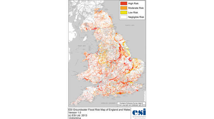
By identifying properties at particular risk of groundwater flooding, the National Groundwater Flood Risk Map helps water companies to develop sewer infiltration reduction plans, says Mark Fermor.